
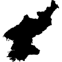
North Korea Interactive Map
Explore major cities, provinces, landmarks, and geography of the Democratic People's Republic of Korea (DPRK)
Map Overview: North Korea occupies the northern part of the Korean Peninsula and shares borders with South Korea, China, and Russia. Use the interactive map below to explore major cities, mountains, rivers, and key locations across the country.
120K
km² Area
26M+
Population
1
Capital City
9
Provinces
🗺️ Interactive North Korea Map
How to use: Zoom in and out, drag the map, and explore North Korea's geographical features, neighboring countries, mountain ranges, and major urban centers.
📍 Major Places on the Map
🏙️ Pyongyang
Capital and largest city.
Capital and largest city.
⛰️ Mount Paektu
Highest mountain in North Korea.
Highest mountain in North Korea.
🌊 Wonsan
Major eastern coastal city.
Major eastern coastal city.
🚢 Nampo
Important port city.
Important port city.
🌏 Geographic Highlights
North Korea is characterized by rugged mountains, forested landscapes, fertile river valleys, and a long coastline along both the Yellow Sea and the Sea of Japan (East Sea).
🏔️ Paektu Mountains
🌲 Forest Regions
🏞️ Yalu River
🌊 Coastal Areas
❄️ Alpine Landscapes
⛵ Fishing Ports
💡 Travel Map Tips
- ✅ Zoom in to explore provincial cities and transportation routes.
- ✅ Use satellite or outdoor map styles for terrain visualization.
- ✅ Compare North Korea's geography with neighboring South Korea and China.
- ✅ Explore mountain regions including the famous Mount Paektu area.
- ✅ View coastal regions along both the Yellow Sea and East Sea.
COUNTRY MAP WITH STATES/PROVINCES BOUNDARIES.
USEFUL COUNTRY INFORMATION, Read more
